Featured Exhibits Menu   >    Chetzemoka Trail Exhibit  >  Four Points   


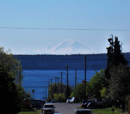
Snow-covered Mount Rainier to the southeast in April 2019.


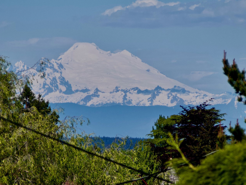
Mt. Baker from Four Points
Photo by Wendy Feltham


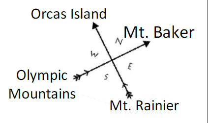
This high spot offers an opportunity to look northeast to Mount Baker (swáʔləx), southeast to Mount Rainier (təqwuʔmaʔ), southwest to the Olympic Mountains (sxwƛ'ayəm'áɬ), and northwest to Mount Constitution on Orcas Island and Vancouver Island’s Saanich Peninsula, home to the Songhees, Esquimalt, Saanich and Cowichan people in Canada (tɬnáʔəč).


From a spot this high, one can see incoming weather patterns and forest fires. Mountains provided valuable hunting and gathering resources. S’Klallams made seasonal visits, traveling by canoe and navigating trail systems that crisscrossed the Peninsula and beyond, in preparation for winters spent at their longhouses. Winters were reserved for storytelling, weaving, toolmaking and other indoor activities, which are being revitalized by many Tribal citizens of all three Klallam/S’Klallam Tribes, including Jamestown Tribal citizens storyteller Elaine Grinnell, weaver Cathy MacGregor, chef Lisa Barrell, drum maker Jeremy Monson, artist Timothy O’Connell, and carver Dusty Humphries.


Looking toward the sign, this is the relative
direction of the peaks you will see on a clear day.


čičməhán Trail Map...


Chetzemoka Park Four Points Fowler Building Hudson Beach/Big Heart Laurel Grove Cemetery Memorial Field North Beach Northwest Maritime Center Port Townsend Ferry Overlook Point Hudson Port Townsend Post Office Point Wilson qatay Lagoon qatay Prairie qatay Valley entinel Rock Swan School Union Wharf/Indian Island


Click the markers on the map above to visit the
trail site pages.


Trail Sign Locations:


  1. Chetzemoka Park
    900 Jackson St. (main entrance)
     
  2. Hudson Beach/Big Heart
    103 Hudson St.
     
  3. Point Hudson
    103 Hudson St.
     
  4. Northwest Maritime Center
    Water St. & Monroe St.
     
  5. Village at Memorial Field
    Washington St.
     
  6. Fowler Building
    226 Adams St.
     
  7. Union Wharf/Indian Island
    Wharf on end of Taylor St.
     
  8. Port Townsend Ferry Overlook
    1200 Block of Washington St.
     
  9. Port Townsend Post Office
    1322 Washington St.
     
  10. qatáy Lagoon

     
  11. Laurel Grove Cemetery
    24th St. & Discovery Rd.
     
  12. Swan School / Klallam language
    2345 Kuhn St.
     
  13. Sentinel Rock
    1948 Blaine St. (Golf Course)
     
  14. qatáy Prairie
    1948 Blaine St.
     
  15. Four Points
    Blaine St. & and VanBuren St.
     
  16. qatáy Valley
    Pacific Ave.& Milo St.
     
  17. North Beach
    End of Kuhn St.
     
  18. Point Wilson
    Fort Worden
     
  19.  


Previous Trail Sign


Next Trail Sign

qatáy Prairie 


 qatáy Valley


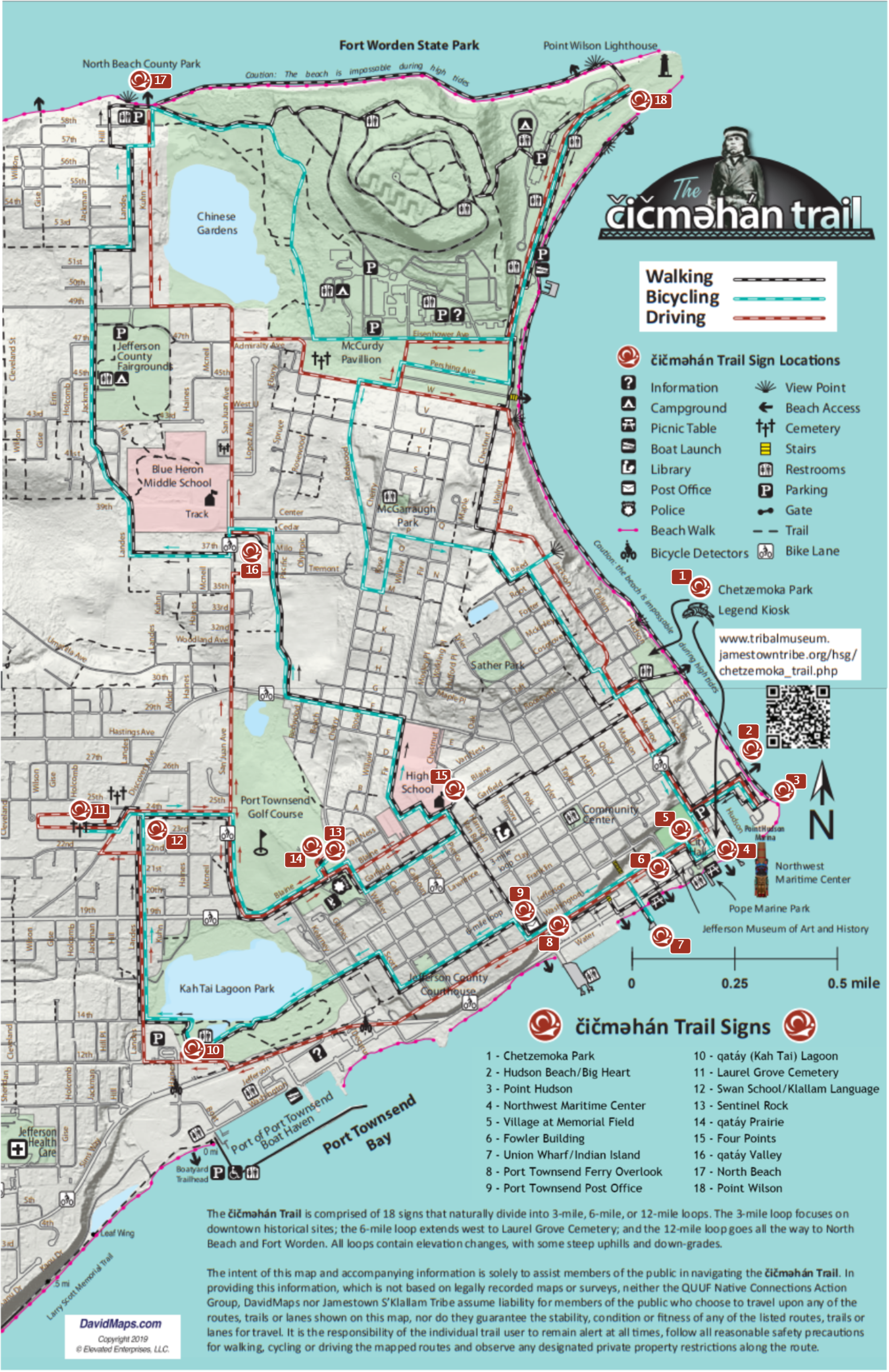
Exhibit Home   |   Sponsors   |   About   |   PDF Trail Map