| Home | |

|

|
|
|
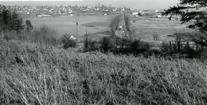
Port Townsend’s Kah Tai Lagoon, before it was filled in. Photo is dated March 9, 1963. The lagoon was filled in shortly after this photo was taken. From the collections of the Jefferson County Historical Society [2010.25.796]
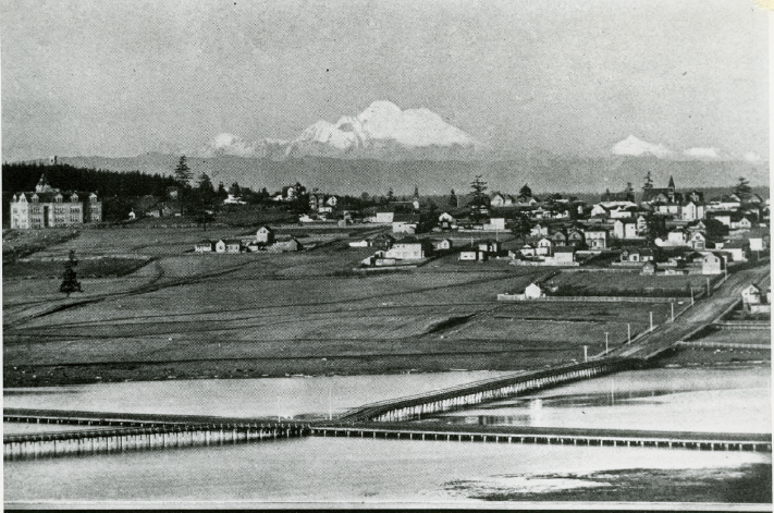
 View of section of town taken from Eisenbeis Addition in 1903. Shows Mount Baker, Lincoln School, and Kah Tai Lagoon with railroad trestle. Looking north toward town, you can see that the lagoon completely blocked access to the land on the other side, protecting qatáy on three sides by water.
From the collections of the Jefferson County Historical Society [2005.75.16]
View of section of town taken from Eisenbeis Addition in 1903. Shows Mount Baker, Lincoln School, and Kah Tai Lagoon with railroad trestle. Looking north toward town, you can see that the lagoon completely blocked access to the land on the other side, protecting qatáy on three sides by water.
From the collections of the Jefferson County Historical Society [2005.75.16]
|
The official name Kai Tai Lagoon is from the Chemakum name qətáaluqo, which was adapted into the S’Klallam word qatáy (kah-tai). The lagoon and a series of ponds in the qatáy Valley (roughly following present-day San Juan Avenue) were used to haul Native canoes from the Strait of Juan de Fuca to Port Townsend Bay in order to avoid the treacherous rip tides around Point Wilson. These wetlands were a valuable resource for the S’Klallam, who frequently hunted waterfowl along the shores and gathered tule grass for weaving. George Vancouver wrote about the lagoon in his 1792 journal.
When the population of Port Townsend began to grow in the late 19th century, the lagoon became a barrier to expansion and the town built a series of wooden bridges across it. In the early 1930s, the new Sims Way isolated the lagoon from Port Townsend Bay and effects of the tides. Needing more land for marine projects, the bay side was dredged and filled. Despite public outcry, by 1963 the Southern end of the lagoon was also filled. With no new development, the land began to recover, and grasses, trees and shrubs along the highway were replanted.
In 1976, City Council rezoned twelve acres of the southern portion for development. Safeway built a 40,000 sf store on the property. Haines Street Park and Ride occupies a corner of that property.
This park is what remains of the northeastern-most portion of qatáy wetland and tidal flats, connected to the larger qatáy Valley that continues north to North Beach. |
|
Previous Trail Sign |
Next Trail Sign |
|
|
|
||
|
Laurel Grove Cemetery
|
|
 Port Townsend Post Office
|
 Exhibit Home | Sponsors | About | PDF Trail Map
|
|
|||||||||||||